Collins Maps: Collins Essential Road Atlas Europe - Taschenbuch
Artikelnummer:
9780008403966
€ 20,20
inkl. MwSt.
Lieferzeit
Innerhalb Österreich 3-5 Werktage
Keine Lieferung nach Deutschland
So einfach gehts:
Bestellen Sie sich die Artikel bequem nach Hause oder in Ihre Lieblingsfiliale. Anhand der Farbe des Lieferwagens können Sie erkennen ob der Artikel momentan in unserem Versandlager verfügbar ist. Grün bedeutet verfügbar. Rot bedeutet momentan nicht verfügbar.
Abholung in der Filiale
(Click & Collect)
So einfach gehts:
Lass dir deine Artikel sofort in der Filiale reservieren. Anhand der Farbe der Einkaufstasche kannst du erkennen ob deine Wunschfiliale den Artikel im Moment auf Lager hat. Grün bedeutet verfügbar. Rot bedeutet momentan nicht verfügbar. Sollten deine Wunschartikel nicht vollständig in deiner Lieblingsfiliale verfügbar sein, so schlagen wir dir gerne im Warenkorb eine andere Filiale vor, in welcher du alle Artikel abholen kannst.
Bitte beachte das die Lagerstände bis zu 30 Minuten alt sein können.
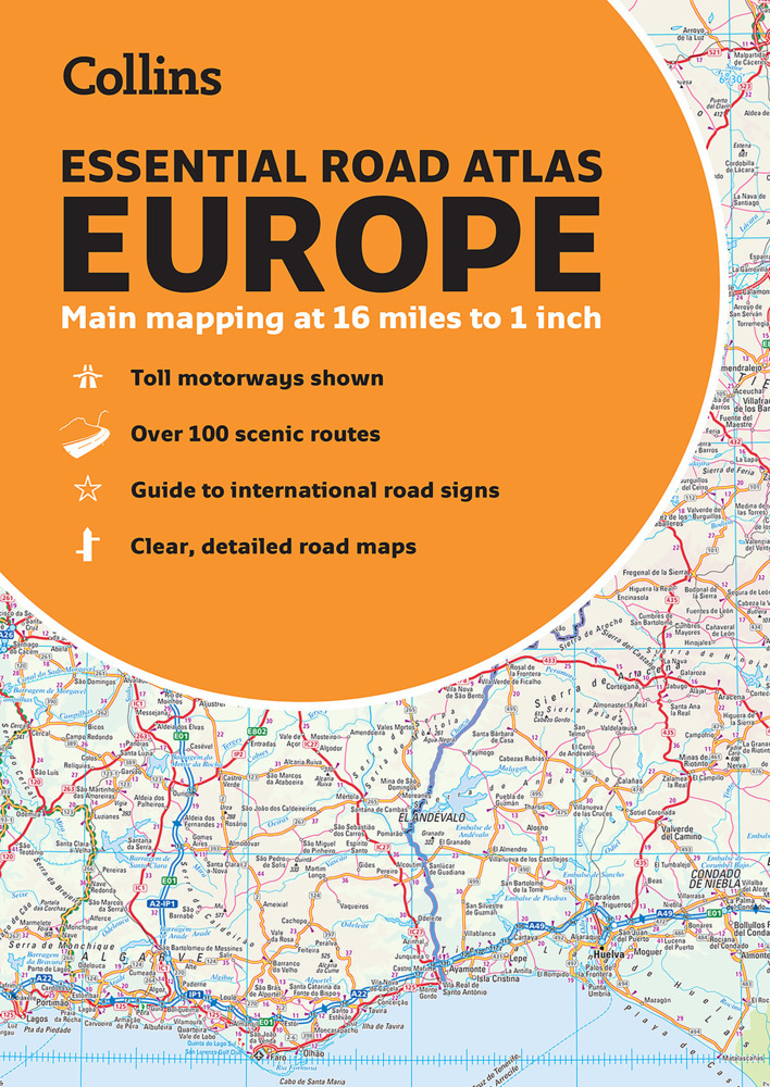
Discover new places with handy road atlases from Collins.
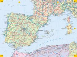
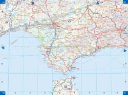
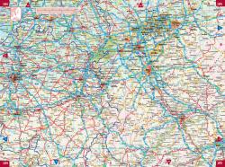
Up-to-date A4 paperback road atlas of Europe. Contains clear, large-scale, detailed road mapping, perfect for touring the Mediterranean, Iberian peninsula, Scandinavia and all European tourist destinations.
Scale of main maps 1:1,000,000 (1 cm to 10 km / 1 inch to 16 miles).
Main features
Clear, easy to follow road maps at a scale of 1:1,000,000. Euroroutes and motorways are easily distinguished on the mapping. The maps also show international road classifications, road distances in kilometres and relief is shown by attractive layer tints.
- Route planning maps
- Over 100 scenic routes shown
- Toll motorways shown
- Guide to international road signs, driving advice and useful internet links
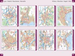
- Route maps of 64 major cities
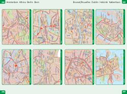
- Street plans of 16 major cities
- Locator diagrams on each page to help you navigate
- More detailed road maps extending from Amsterdam to Munich, making route following easier through this densely populated area
Area of coverage
The mapping extends from the North Cape (Norway) to Gibraltar and from Ireland to east of Moscow. Also includes Iceland and Cyprus.
| Höhe | 296 mm |
|---|---|
| Anzahl Seiten | 0 |
| Autor | Collins Maps |
| Verlag | Collins |
| Erscheinungsjahr | 2022 |
| Eigengewicht | 690 g |
| ISBN | 9780008403966 |
| Medium | Taschenbuch |
| Herstellerinfo | <p>The use of light colours in the maps and a 3.2mpi scale make the Collins Essential easy to read at a glance Auto Express</p> |